![]()
![]()
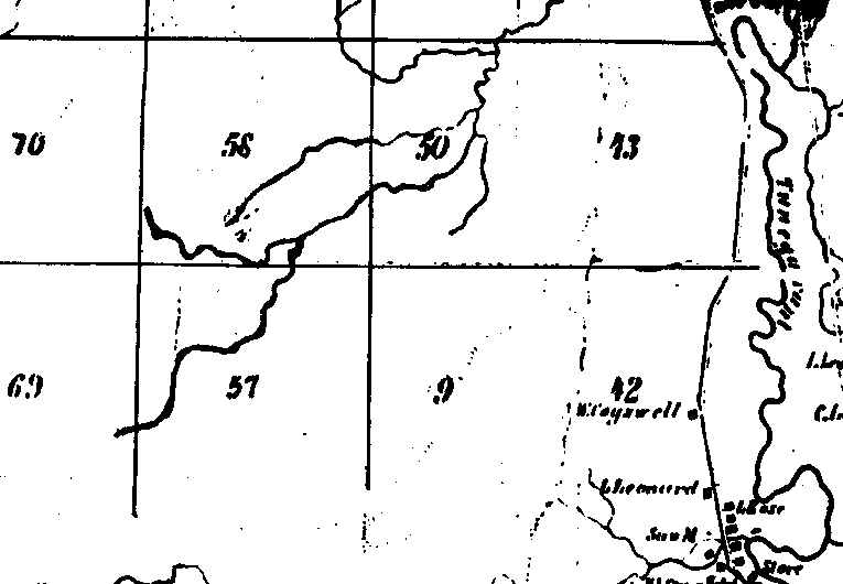
This is an 1855 map which indicates that in the area of our study no residents were present.
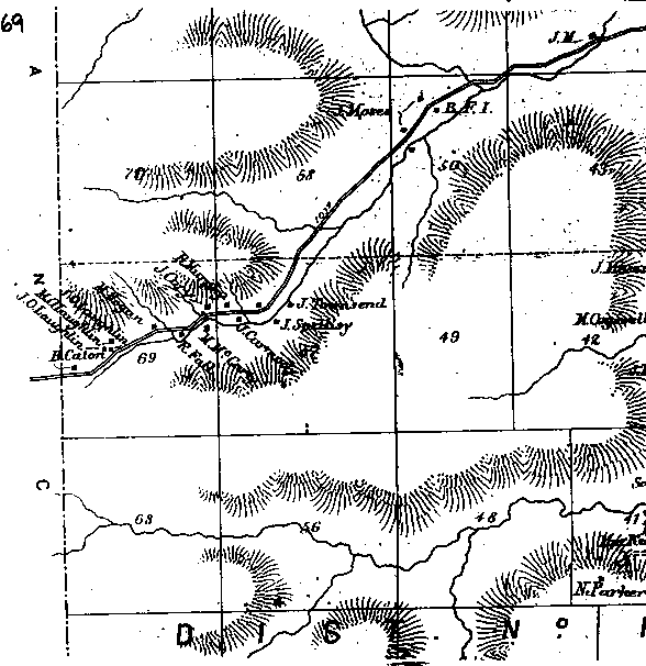
New Ireland circa 1869 - This map indicates the original twelve families that settled in New Ireland
This is a map of the New Ireland settlement in the year 1897. You can see a transfer of property from some of the original families. It seems that the Townsell property has been taken by P.Keough and J.Rochford. The Spellacy family has clearly become the largest landowner in New Ireland. The Carmodys and McCartys have left and ownership of their land appears to have transferred to J. Spellacy, P.Keough and P. O'Laughlin. The Falls are still listed as owning property but it is now under the names M. Fall and R.Fall. The Murphys are gone and M.Parkhill has replaced them. Bridget Hogan is now shown as the owner of the family acreage replacing her husband Michael who had past away. The O'Laughlin brothers still are in possession of their property and B. Caton has been replaced by P. Keating.
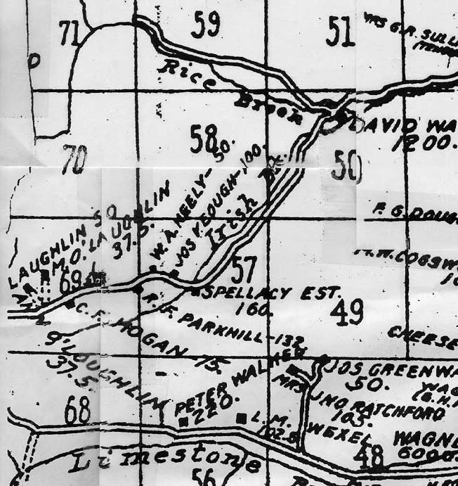
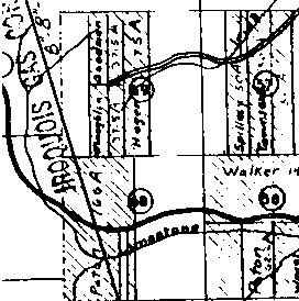
This is a map of New Ireland circa 1914. As you can see the settlement has grown considerably in size since 1869. There has again been several changes in property ownership and you can see a school is depicted to the right of the number 69. The Hogan residence has been moved across the road. The numbers that appear after the names, indicate the acreage owned(i.e. Spellacy Est.-160 acres).
This map is from the year 1934. The blank areas now indicate that the land has been transferred to the State of New York and in turn will become a part of Allegany State Park. However, you may note that at this time the Hogans, O'Laughlins, and Spellacys still are shown as being property owners and reappearing is the Townsell name. The intermarriage between the Spellacys and the Townsells may account for the return of the Townsell listing. A new name appears: Goodman,who owns 37.5 acres. The map also indicates that the Spellacys only own 50 acres which is significantly reduced from the previous 160.
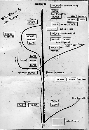
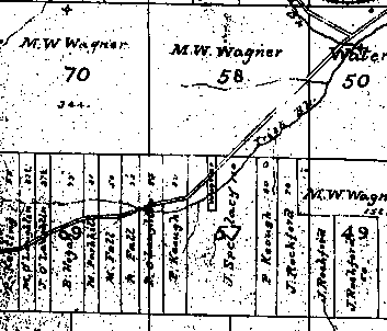
This is a hand drawn map from the recollection of James Keough, one of the last surviving residents of the New Ireland settlement.